An ice storm hit Iowa and eastern Nebraska last weekend, closing a major highway as cars and trucks slid off the road. At least one person died in a crash due to icy roads in Nebraska.
The National Weather Service in Des Moines issued a dense fog advisory on Saturday that would remain in effect until 11 a.m. CT on Sunday. Thick fog spread across much of the state, reducing visibility to a quarter mile or less in some places, the weather service said. The ice had turned mostly to freezing rain by Saturday night, but roads in eastern Iowa were still at least partially covered in ice or snow, forecasters said.
Authorities say one person died while driving on icy roads in eastern Nebraska. The Washington County Sheriff’s Office said a 57-year-old woman died in a crash after she lost control of her pickup on Highway 30 near Arlington and struck an oncoming truck. The other driver suffered minor injuries in the accident. Washington County is close to Nebraska’s eastern border with Iowa, near Omaha.
Roads in that area were slick enough Saturday to play hockey in the streets, as someone did in a social media video that the National Weather Service in Omaha reposted. A dense fog warning was also in effect in the region through Sunday at 11 a.m. CT.
“Dense fog continues to develop across our area and is expected to persist into tomorrow morning,” the National Weather Service in Omaha wrote in an advisory Saturday evening. “With less than a quarter mile of visibility at times and slippery spots on some roads, be careful and take it easy when you’re out and about!”
Forecasters warned that untreated roads could refreeze overnight as temperatures dropped.
Many events in the region were canceled when the storm hit Friday evening, and businesses announced plans to open late Saturday as officials urged people to stay home if possible. However, temperatures rose so high in the afternoon that the ice began to melt in most places.
“Luckily some warmer air is moving in behind this to make it temporary,” said Dave Cousins, a meteorologist with the National Weather Service office in Davenport, Iowa.
Elsewhere, a storm and wind gusts of up to 60 mph triggered the first tornado warning in San Francisco and caused some damage. Parts of neighboring San Mateo County were also included in the warning, which went out to about 1 million people at 5:51 a.m. and was lifted about 20 minutes later.
Later Saturday, a tornado touched down near a shopping center in Scotts Valley, near the city of Santa Cruz, about 70 miles (110 kilometers) south of San Francisco, overturning cars and toppling trees and utility poles, the National Weather Service said.
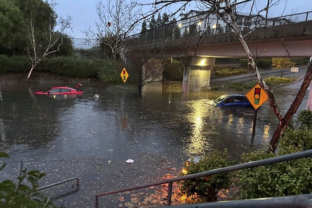
Livermore Police via AP
“Based on video, photographs, first-hand accounts and radar signatures, a tornado occurred at 1:40 p.m.,” the agency said, adding that a team will investigate and prepare a ranking.
Images uploaded to social media showed at least three vehicles on their hoods or sides, with broken windshields and trees and power lines on the ground.
Several people were injured and taken to hospitals, Scotts Valley police said.
“The tornado caused extensive damage in several areas, including overturning several vehicles in and around the shopping area on Mt. Hermon Drive,” the department said in a statement. People were asked to avoid the area.
One of the injured was a battalion chief with the California Department of Forestry and Fire Protection, KSBW-TV reported.
In San Francisco, some trees fell on cars and streets and damaged roofs. The city hasn’t seen a tornado since 2005, according to the weather service. Damage was assessed to determine if the city was indeed struck by a tornado.
“This was the very first warning of a possible tornado in San Francisco. I suspect there was no clear signature on the radar for a warning in 2005,” said Roger Gass, a meteorologist with the Weather Service in Monterey, California. He said he wasn’t there in 2005.
The fast-moving storm prompted warnings for residents to take shelter, but few people have basements in the area.
“The biggest thing we tell people in the city is to put as many walls between you and the outside world as possible,” said meteorologist Dalton Behringer.
In New York State, people were digging after heavy snow fell. Near Orchard Park, where residents are used to lake-effect snow this time of year, more than 3 feet were reported.
And in Nevada, up to a meter of snow was forecast on the mountain peaks of the Sierra Nevada. According to the National Weather Service’s Reno office, more than a foot fell at some Lake Tahoe ski resorts, and the Mammoth Mountain resort south of Yosemite National Park recorded wind gusts of 110 mph.
A winter storm warning was set to expire at 10 p.m. PT on Saturday, but an avalanche warning remained in effect until the following night for elevations above 7,000 feet around Tahoe.
Interstate 80 was closed along an 80-mile stretch from Applegate, California, to the Nevada line just west of Reno, where it was raining and a winter weather advisory was in effect all afternoon. The California Highway Patrol reopened the road in the afternoon to passenger cars with chains or four-wheel drive and snow tires, although it remained closed to semi-trailer trucks.
Tens of thousands of people in western Washington lost electricity on Saturday, local news media reported, amid a system that brought rain and gusty winds.


