

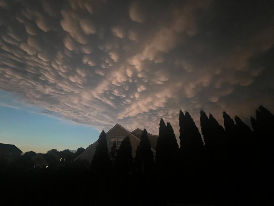
There was no bird, plane, popcorn, cotton balls or giant cow udders in the skies over Bucks County on Sunday night.
So what was it? A unique weather phenomenon.
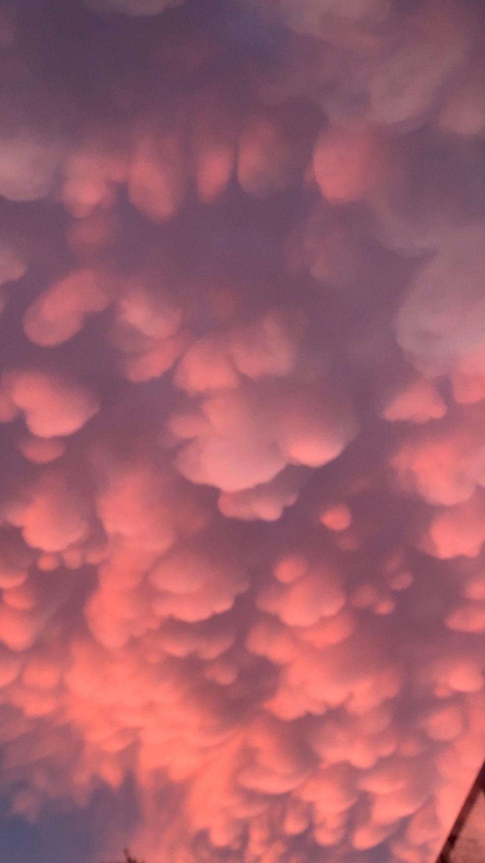
These formations, called mammatus clouds, are condensed pockets of sinking cold air that form at the base of a cloud when it hits a warmer layer of air, creating what appear to some as cow’s udders in the sky.
What made their appearance on Sunday so special was their widespread nature, reaching as far south as northern Delaware and across New Jersey and the Delaware Valley region, said Patrick O’Hara, a meteorologist with the National Weather Service in Mount Holly, New Jersey.
Amateur photographers didn’t hesitate to flood social media Sunday evening with photos of ominous and majestic-looking skies.
“Has anyone looked at the sky tonight? What an amazing cloud,” wrote one poster on the Doylestown Facebook page.
Another person posted, “Suddenly Lake Galena went wild. What a blessing the sky was tonight.”
“There’s been a lot of strange stuff in the sky lately,” someone wrote on the Bensalem Proud Facebook page.
“I have lived five minutes from the Neshaminy Mall my entire married life and I have never seen anything like this. It is just bizarre. Beautiful, but definitely bizarre,” wrote another.
This is what we found out about mammatus cloud formations
What types of clouds are mammatus typically associated with?
These cloud pockets are most often seen with cumulonimbus clouds, which produce strong storms. These clouds typically form during warm months from descending air within the cloud, according to the UCAR Center for Science Education.
What does it mean when you see mammatus clouds?
Potential problems are coming, or they have passed. Mammatus clouds generally form in the most unstable cumulonimbus clouds (the cloud formations that can cause extreme weather). When that happens, they are often a sign of a particularly strong storm.
How do mammatus clouds form?
In large thunderstorms, there is a large mass of water vapor that rises to the top of the atmosphere and spreads out as it sinks, O’Hara said. Normally, these types of clouds form over a smaller area.

Are mammatus clouds dangerous?
Yes, if you are a pilot. Because according to the American Meteorological Society, they are a type of cumulonimbus clouds that can indicate high levels of turbulence. But for those of us on the ground, they are generally harmless, but because they form in unstable air they can signal the possibility of other dangerous weather nearby, such as lightning or hail.
Are mammatus clouds rare?
They’re not uncommon, but they’re most picturesque at sunset, O’Hara said.
Reporter Jo Ciavaglia can be reached at jciavaglia@gannett.com
This article originally appeared in the Bucks County Courier Times: Mammatus clouds fill the sky over the Bucks County region


