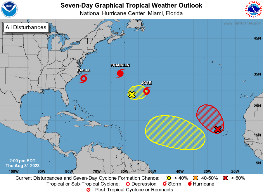
The good news in the tropics continues, although conditions in the Caribbean Sea could favor the development of Tropical Storm Patty late next week.
The same cannot be said for the eastern Pacific, where Hurricane Kristy has grown into a Category 4 storm with sustained winds of 150 miles per hour.
Friday’s National Hurricane Center tropical outlook map shows no disturbances in the Atlantic Basin and none are expected over the next seven days. However, remember that conditions can change at any time and residents – especially those in hard-hit Florida – should always keep an eye on the tropics.
➤ Track all active storms
➤ Weather warnings via SMS: Sign up to receive updates on current storms and weather conditions by location
According to AccuWeather, there is a medium chance of a tropical depression or storm forming in the Caribbean in late October and early November.
The next named storms of the 2024 Atlantic hurricane season are Patty and Rafael.
The Atlantic hurricane season ends on November 30, although storms can – and have – formed after that date, and even before the official start of the hurricane season on June 1.
Here is the latest advice from the NHC as of Friday, October 25 at 2 a.m.:
Tropical Storm Patty? Will Florida experience another storm or hurricane?
AccuWeather forecasters are focusing on the western and central Caribbean Sea, which is expected to produce the next tropical threat. There is a medium chance of a tropical depression or storm forming in these waters in late October and early November.
“I know there will be showers and thunderstorms in this zone next week. The question is wind shear. If there is low wind shear, which we expect, I think we will have a tropical depression or storm,” AccuWeather Chief said . On-air meteorologist Bernie Rayno said.
“Tropical storms that form in this area in late October and early November tend to reach Central America or possibly north-northeast toward Cuba, Hispaniola and the Bahamas,” said AccuWeather Senior Meteorologist Alex Sosnowski.
However, “a track to Florida or the southeastern US mainland cannot be ruled out at this early stage” and residents of the southeastern US, along with those in the Caribbean and Mexico, are encouraged to keep an eye on the tropics and stay prepared.
What else is there and how likely are they to get stronger?

As of 2 a.m., the National Hurricane Center has not observed any tropical disturbances in the Atlantic Basin, which consists of the North Atlantic Ocean, the Caribbean Sea and the Gulf of Mexico.
While there is nothing on the tropical outlook map, NHC forecasters said there are a few tropical waves, including one in the Caribbean:
-
Central Atlantic Ocean: A tropical wave has a magnitude of nearly 56 W from 15 N southward and is moving westward at a speed of 18 to 27 km/h.
-
Caribbean Sea: Another tropical wave in the central Caribbean extends from southern Hispaniola to the Colombia-Venezuela border. It is moving west at a speed of 18 km/h.
Who is likely to be affected?
Forecasters urge all residents to continue to monitor the tropics and always be prepared.
Hurricane Kristy is moving west in the Pacific Ocean with winds of 150 miles per hour


At 5 a.m. EDT, Hurricane Kristy was located 1,100 miles (1,700 kilometers) west-southwest of the southern tip of Baja California.
Maximum sustained winds are 150 miles per hour and the hurricane is moving west-northwest at a speed of 14 miles per hour.
Some intensity fluctuations are expected throughout Friday morning, with rapid weakening expected to begin this evening.
Impact: The swell generated by Kristy will impact parts of the west coast of the Baja California Peninsula on Friday and Saturday. These swells are likely to produce life-threatening surf and rip current conditions.
Hurricane Kristy Spaghetti Models
Special note about spaghetti models: Spaghetti model illustrations cover a variety of forecasting tools and models, and they are not all the same. The Hurricane Center uses only the four or five best-performing models to help make its forecasts.
Weather watches and warnings issued in Florida
Stay informed. Receive weather alerts via SMS
When is the Atlantic Hurricane Season?
The Atlantic hurricane season runs from June 1 to November 30.
The Atlantic Basin includes the North Atlantic Ocean, the Caribbean Sea and the Gulf of Mexico.
Countdown clock: when does hurricane season end?
Interactive map: hurricanes, tropical storms that have passed near your city
What’s next?
We will continue to update our tropical weather coverage daily. Download the app from your local site to ensure you’re always up to date with the news. And look here for our special subscription offers.
This article originally appeared on Florida Times-Union: Tropics watch: Atlantic basin quiet. Tropical threat in the Caribbean?


