

As Hurricane Debby approached the coast of Florida’s Big Bend early Monday morning, thousands of people in Polk County woke up without power after a night of high winds and rain.
Lakeland Electric’s outage map as of 6:45 a.m. showed more than 2,787 people without power in 47 separate outages, with the largest affecting more than 1,400 customers near Griffin and Kathleen roads. Another 900 customers were without power in the area between Lake Hollingsworth and Polk Parkway.
Electricians were quick to respond, halving the number of people affected by the power outage in southern Lakeland in less than 5 minutes Monday morning.
Tampa Electric Co.’s outage map showed more than 100 power outages in the area from Wahneta to Polk City.
Duke Energy reported only two power outages affecting individual customers in East Polk.
Polk County Public Schools
Polk County Public Schools sent an early morning message to teachers who had scheduled full-day trainings per grade level at locations across the county, delaying the required start time.
“Following this morning’s weather forecast, Superintendent (Frederick) Heid has decided to postpone activities for this morning’s contact day,” the message to teachers read at 6:50 a.m. “All meetings and practices will be postponed until 9 a.m.”
The contact days are central days for teacher development, where teachers from across the region come together with other teachers and staff from their field to discuss new teaching materials and resources.
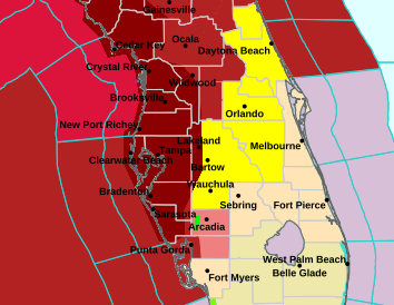
Polk County remains under a tornado warning until 4 p.m.
The tornado warning, which was scheduled to end at 6 a.m., has been extended until 4 p.m. Monday.
A tropical storm warning is also again in effect for the far west of the region, including western Lakeland and Kathleen.
Severe storms associated with Hurricane Debby continue to move along the coast and across the region.
Weather forecast for Lakeland
According to the National Weather Service
Today: Showers and possibly thunderstorms. Some storms can produce heavy rainfall. High around 85. Windy, with a south-southwest wind around 23 mph, with gusts as high as 31 mph. Chance of precipitation is 80%. New rainfall amounts of 2 to 3 inches possible.
This evening: Showers and possibly thunderstorms likely. Some storms can produce heavy rainfall. Mostly cloudy, with a low near 77. Windy, with a south-southwest wind 16 to 18 mph, with gusts as high as 25 mph. Chance of precipitation is 70%. New rainfall amounts of one-half to three-quarters of an inch possible.
Tuesday: Showers and possibly thunderstorms. High around 89. Heat index values as high as 105. Windy, with a southwest wind 15 to 18 mph, with gusts as high as 24 mph. Chance of precipitation is 80%. New precipitation amounts between a half and three-quarters of an inch possible.
Tuesday night: Scattered showers and thunderstorms. Partly cloudy, with a low around 78. West southwest wind 11 to 13 mph. Chance of precipitation is 40%.
Weather forecast for Winter Haven
Today: Showers and possibly thunderstorms. Some storms can produce heavy rainfall. High around 87. Heat index values as high as 98. Windy, with a south wind 18 to 23 mph, with gusts as high as 30 mph. Chance of precipitation is 80%. New rainfall amounts of 1 to 2 inches possible.
This evening:Possible showers and a possible thunderstorm before 2:00 AM, then scattered showers and thunderstorms after 2:00 AM. Some of the storms can produce heavy rainfall. Mostly cloudy, with a low near 78. Windy, with a south-southwest wind 15 to 17 mph, with gusts as high as 23 mph. Chance of precipitation is 60%. New rainfall amounts of a quarter to a half inch possible.
Tuesday: Scattered showers and thunderstorms, then showers and a possible thunderstorm after 8 AM. High near 90. Heat index as high as 105. Windy, with a southwest wind 15 to 17 mph, with gusts as high as 23 mph. Chance of precipitation is 80%. New precipitation amounts of a quarter to a half inch possible.
Tuesday night: Showers and possible thunderstorms before 8pm, then scattered showers and thunderstorms after 8pm. Low around 78. West southwest wind around 11 mph. Chance of precipitation is 80%.
Do you have photos or more information?
Are you seeing funnel clouds or significant flooding in your area? Let us know. Do you have photos? Send them to newstips@theledger.com. Please include the time the photo was taken and the most detailed location possible.
This article originally appeared on The Ledger: Live Debby Updates: Thousands in Polk Without Power Early Monday Morning


