

Vandals have been captured on video destroying protected rock formations in the Lake Mead National Recreation Area, and park rangers are seeking the public’s help in identifying them.
So what happened? And where is Lake Mead? Here’s what we know.
Visitors destroy federally protected formations at Lake Mead
According to CNN, a few visitors climbed the rocks along the park’s Redstone Dune Trail and pushed sandstone slabs to the ground. Recreation area spokesman John Haynes called the destruction of the federally protected formations “terrible.”
According to the KVVU, the video was recorded on April 7. The men are suspected of vandalism, the recreation area reported in an Instagram post.
Where is Lake Mead? What condition is it in?
Lake Mead is a reservoir on the border of Nevada and Arizona. It was formed by the Hoover Dam along the Colorado River.
When full, Lake Mead is the largest reservoir in the United States by volume and second only to Lake Powell by surface area, according to the National Park Service. It was first flooded in 1935 and supplies water to Arizona, California, Nevada and part of Mexico.
Lake Mead National Recreation Area covers 1.5 million acres, including two lakes, mountains, canyons, valleys and wilderness.
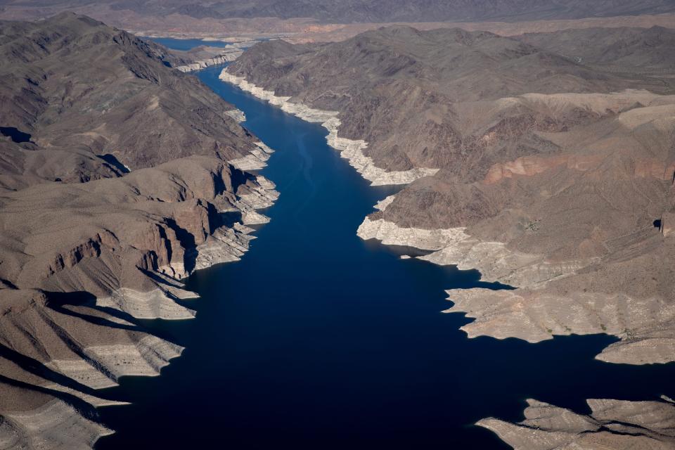
Lake Mead water levels hit their highest point in three years, but are falling again
According to Bureau of Reclamation measurements, Lake Mead’s water level stood at 1,000 feet at the end of February, higher than the level measured in late January. Before this year, the most recent highest level was recorded in April 2021, when it was measured at 1,079.30 feet.
However, Newsweek reports that the level is falling again and is at 1,074.06 feet on April 13. This is 154.94 feet below the full pool level of 1,229 feet.
Some areas in the Southwest are still experiencing drought, although almost all of California is no longer in that classification.
Drought areas in California are located in the north along the border with Oregon, in the east along the border with Nevada and in the southeast along the border with Arizona.
This article originally appeared on Record-Courier: Where is Lake Mead? Vandals destroy protected rock formations


